
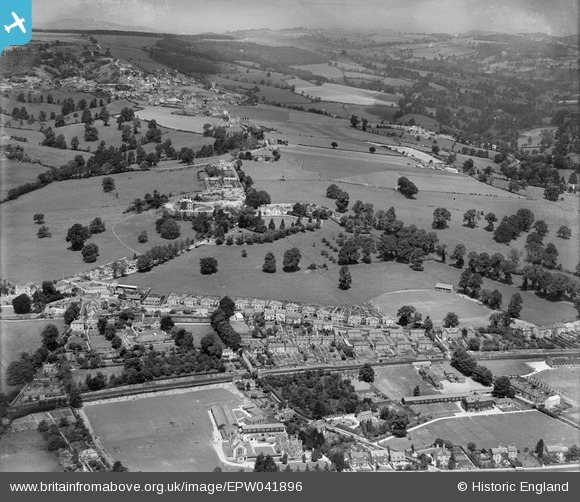
EPW041896 ENGLAND (1933). Farmhill Park and environs, Stroud, from the south, 1933,
© Copyright OpenStreetMap contributors and licensed by the OpenStreetMap Foundation. 2026. Cartography is licensed as CC BY-SA.
Nearby Images (3)
EPW041896

EPW041894

EPW041895

Details
| Title | [EPW041896] Farmhill Park and environs, Stroud, from the south, 1933, |
| Reference | EPW041896 |
| Date | June-1933 |
| Link | |
| Place name | STROUD |
| Parish | STROUD |
| District | |
| Country | ENGLAND |
| Easting / Northing | 383944, 205571 |
| Longitude / Latitude | -2.2325997452124, 51.748151013201 |
| National Grid Reference | SO839056 |
Pins

James Chandler |
Sunday 31st of July 2016 05:53:38 PM | |
|
The Cornish Northerner |
Tuesday 8th of September 2015 11:22:08 AM | |
|
The Cornish Northerner |
Tuesday 8th of September 2015 11:21:34 AM |