
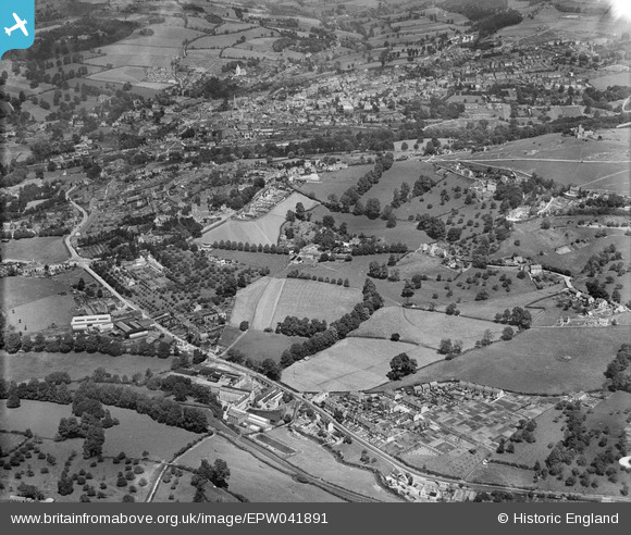
EPW041891 ENGLAND (1933). Stringer's Farm, Lightpill Erinoid Mills and environs, Rodborough, 1933,
© Copyright OpenStreetMap contributors and licensed by the OpenStreetMap Foundation. 2026. Cartography is licensed as CC BY-SA.
Nearby Images (3)
EPW041891

EPW041890

EPW041866

Details
| Title | [EPW041891] Stringer's Farm, Lightpill Erinoid Mills and environs, Rodborough, 1933, |
| Reference | EPW041891 |
| Date | June-1933 |
| Link | |
| Place name | RODBOROUGH |
| Parish | RODBOROUGH |
| District | |
| Country | ENGLAND |
| Easting / Northing | 384362, 204219 |
| Longitude / Latitude | -2.2264835290108, 51.736005567936 |
| National Grid Reference | SO844042 |
Pins

John Reynolds |
Saturday 27th of November 2021 04:57:07 PM | |
|
totoro |
Tuesday 10th of January 2017 05:30:37 PM | |
|
totoro |
Tuesday 10th of January 2017 05:24:33 PM | |
|
totoro |
Tuesday 10th of January 2017 05:22:07 PM | |
|
totoro |
Tuesday 10th of January 2017 05:08:50 PM | |
|
cookie |
Saturday 1st of March 2014 05:01:01 PM | |
|
cookie |
Saturday 1st of March 2014 05:00:03 PM |