
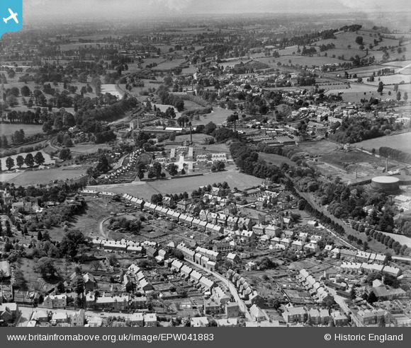
EPW041883 ENGLAND (1933). Paynes Place, Bath Road and environs, Rodborough, from the east, 1933
© Copyright OpenStreetMap contributors and licensed by the OpenStreetMap Foundation. 2026. Cartography is licensed as CC BY-SA.
Nearby Images (5)
EPW041883

EPW041882

EPW059688

EPW059696

EPW059689

Details
| Title | [EPW041883] Paynes Place, Bath Road and environs, Rodborough, from the east, 1933 |
| Reference | EPW041883 |
| Date | June-1933 |
| Link | |
| Place name | RODBOROUGH |
| Parish | RODBOROUGH |
| District | |
| Country | ENGLAND |
| Easting / Northing | 384258, 204660 |
| Longitude / Latitude | -2.2280096944405, 51.739968158888 |
| National Grid Reference | SO843047 |
Pins

Robert |
Monday 11th of January 2016 01:05:35 PM | |
|
Robert |
Monday 11th of January 2016 01:03:19 PM | |
|
gBr |
Tuesday 5th of January 2016 07:38:27 PM | |
|
gBr |
Tuesday 5th of January 2016 07:37:45 PM | |
|
gBr |
Tuesday 5th of January 2016 07:34:38 PM | |
|
gBr |
Tuesday 5th of January 2016 07:30:56 PM | |
|
gBr |
Tuesday 5th of January 2016 07:29:21 PM | |
|
gBr |
Tuesday 5th of January 2016 07:28:00 PM | |
|
gBr |
Tuesday 5th of January 2016 07:24:22 PM | |
|
gBr |
Tuesday 5th of January 2016 07:10:27 PM |


User Comment Contributions
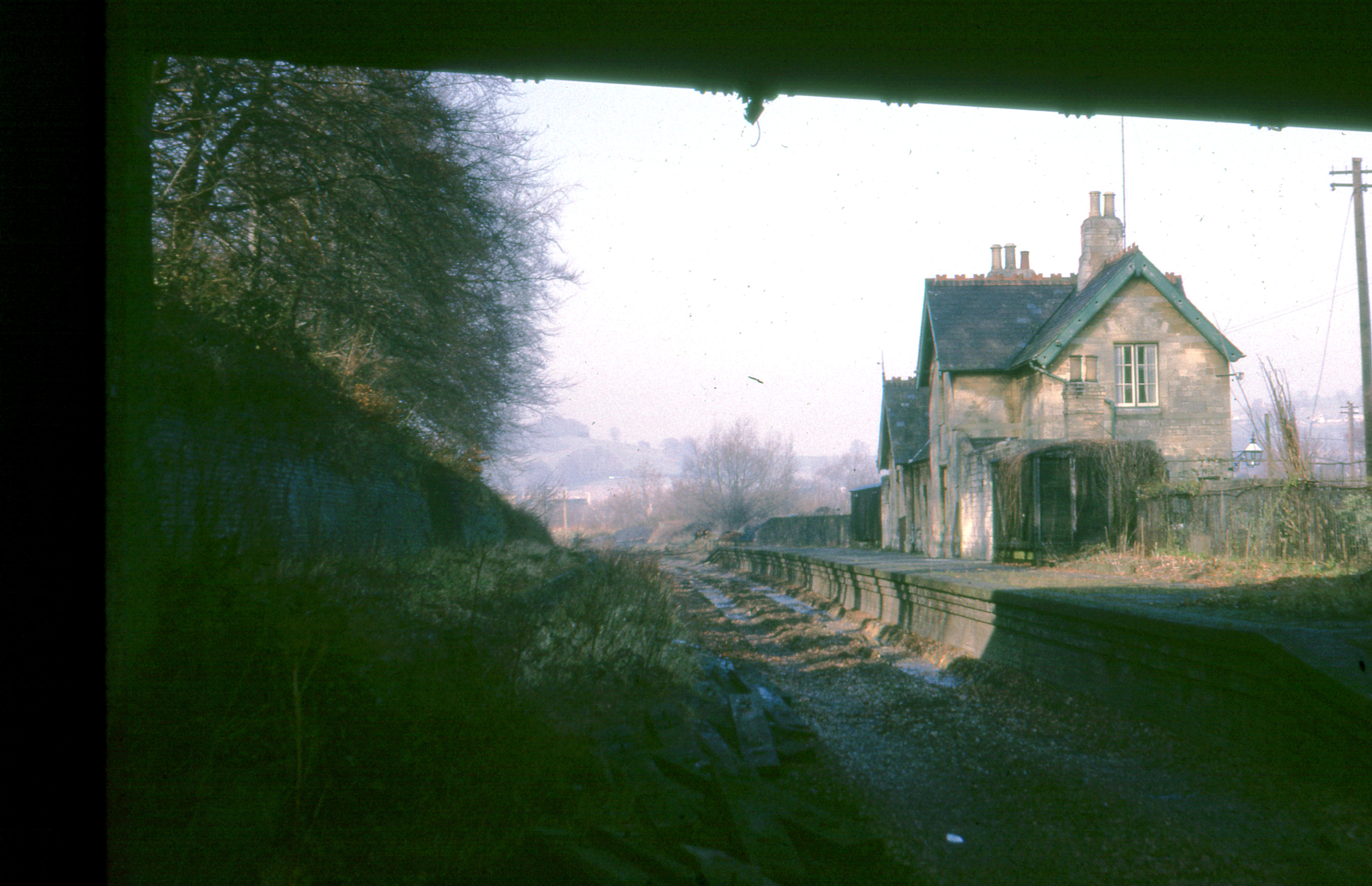
Dudbridge Railway station with track lifted |
Robert |
Monday 11th of January 2016 01:11:59 PM |