
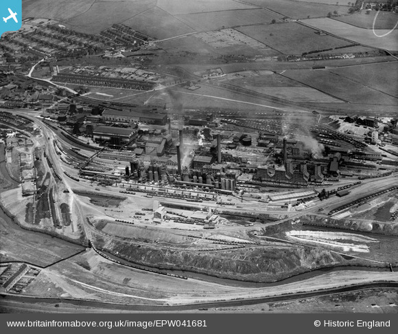
EPW041681 ENGLAND (1933). The Devonshire Iron and Chemical Works, Staveley, 1933
© Copyright OpenStreetMap contributors and licensed by the OpenStreetMap Foundation. 2026. Cartography is licensed as CC BY-SA.
Nearby Images (20)
EPW041681

EPW041679

EAW003066

EPW057353

EPW041682

EPW041678

EAW044350

EAW003062

EPW041673

EPW041676

EAW003069

EPW057344

EPW057332

EPW057336

EPW041680

EPW057354

EAW003064

EAW003063

EAW009691

EPW057338

Details
| Title | [EPW041681] The Devonshire Iron and Chemical Works, Staveley, 1933 |
| Reference | EPW041681 |
| Date | June-1933 |
| Link | |
| Place name | STAVELEY |
| Parish | STAVELEY |
| District | |
| Country | ENGLAND |
| Easting / Northing | 442369, 374859 |
| Longitude / Latitude | -1.3646501476434, 53.26875094182 |
| National Grid Reference | SK424749 |
Pins

Peter Turvey |
Friday 24th of April 2015 07:04:07 PM |