
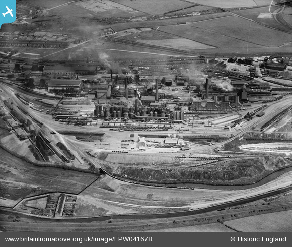
EPW041678 ENGLAND (1933). The Devonshire Iron and Chemical Works, Staveley, 1933
© Copyright OpenStreetMap contributors and licensed by the OpenStreetMap Foundation. 2026. Cartography is licensed as CC BY-SA.
Nearby Images (21)
EPW041678

EAW044350

EAW003062

EAW003069

EPW057336

EPW057353

EPW041681

EAW003066

EPW057344

EPW041679

EPW041682

EPW057332

EPW041673

EAW003063

EPW041676

EPW041680

EPW057354

EAW003064

EAW009691

EAW043848

EPW057338

Details
| Title | [EPW041678] The Devonshire Iron and Chemical Works, Staveley, 1933 |
| Reference | EPW041678 |
| Date | June-1933 |
| Link | |
| Place name | STAVELEY |
| Parish | STAVELEY |
| District | |
| Country | ENGLAND |
| Easting / Northing | 442379, 374777 |
| Longitude / Latitude | -1.3645111316072, 53.268013023653 |
| National Grid Reference | SK424748 |
Pins

eric watts |
Sunday 31st of August 2014 02:17:09 PM | |
|
eric watts |
Sunday 31st of August 2014 02:16:41 PM | |
|
eric watts |
Sunday 31st of August 2014 02:15:39 PM |