
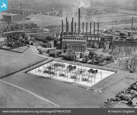
EPW041532 ENGLAND (1933). Dumplington electrical substation on Redclyffe Road, Dumplington, 1933
© Copyright OpenStreetMap contributors and licensed by the OpenStreetMap Foundation. 2026. Cartography is licensed as CC BY-SA.
Nearby Images (8)
EPW041532

EPW027776

EPW027510

EPW041531

EPW041530

EAW006232

EAW000111

EAW006233

Details
| Title | [EPW041532] Dumplington electrical substation on Redclyffe Road, Dumplington, 1933 |
| Reference | EPW041532 |
| Date | June-1933 |
| Link | |
| Place name | DUMPLINGTON |
| Parish | |
| District | |
| Country | ENGLAND |
| Easting / Northing | 376801, 397308 |
| Longitude / Latitude | -2.3495399699279, 53.471741102001 |
| National Grid Reference | SJ768973 |
Pins

Richard |
Tuesday 22nd of August 2017 06:54:49 PM | |
|
Stretfordian |
Tuesday 5th of January 2016 01:34:05 AM | |
|
Stretfordian |
Tuesday 5th of January 2016 01:33:19 AM | |
|
Stretfordian |
Tuesday 5th of January 2016 01:31:25 AM | |
|
Stretfordian |
Tuesday 5th of January 2016 01:30:28 AM | |
|
Stretfordian |
Tuesday 5th of January 2016 01:29:21 AM | |
|
Stretfordian |
Tuesday 5th of January 2016 01:27:57 AM | |
|
stardelta |
Wednesday 11th of June 2014 11:36:36 PM | |
|
stardelta |
Wednesday 11th of June 2014 11:23:42 PM |