
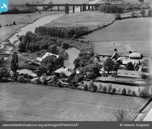
EPW041437 ENGLAND (1933). The Sharnbrook Viaduct, River Great Ouse and Stoke Corn Mill, Sharnbrook, 1933
© Copyright OpenStreetMap contributors and licensed by the OpenStreetMap Foundation. 2026. Cartography is licensed as CC BY-SA.
Nearby Images (9)
EPW041437

EPW041438

EPW041444

EPW041443

EPW041442

EPW041445

EPW041441

EPW041440

EPW041439

Details
| Title | [EPW041437] The Sharnbrook Viaduct, River Great Ouse and Stoke Corn Mill, Sharnbrook, 1933 |
| Reference | EPW041437 |
| Date | June-1933 |
| Link | |
| Place name | SHARNBROOK |
| Parish | SHARNBROOK |
| District | |
| Country | ENGLAND |
| Easting / Northing | 501100, 259093 |
| Longitude / Latitude | -0.51986324889793, 52.22035683912 |
| National Grid Reference | TL011591 |
Pins

Becquerel235 |
Monday 14th of February 2022 07:32:41 PM | |
|
John Wass |
Tuesday 30th of June 2015 02:57:59 PM |