
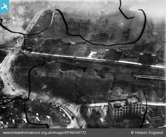
EPW040772 ENGLAND (1932). The Virol Factory, Hanger Lane and Wellington House, Ealing, 1932. This image has been produced from a damaged negative.
© Copyright OpenStreetMap contributors and licensed by the OpenStreetMap Foundation. 2026. Cartography is licensed as CC BY-SA.
Nearby Images (18)
EPW040772

EPW040865

EPW040873

EPW040874

EPW040863

EPW022713

EPW022714

EPW008079

EAW048757

EPW009231

EPW009229

EPW009228

EPW009226

EPW022712

EPW009227

EPW009225

EPW009230

EAW048738

Details
| Title | [EPW040772] The Virol Factory, Hanger Lane and Wellington House, Ealing, 1932. This image has been produced from a damaged negative. |
| Reference | EPW040772 |
| Date | December-1932 |
| Link | |
| Place name | EALING |
| Parish | |
| District | |
| Country | ENGLAND |
| Easting / Northing | 518373, 182645 |
| Longitude / Latitude | -0.29331610228325, 51.529810030567 |
| National Grid Reference | TQ184826 |
