
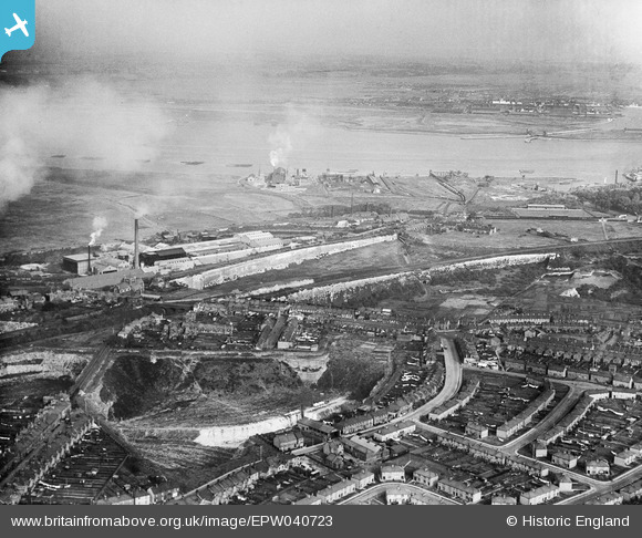
EPW040723 ENGLAND (1932). The High Street and factories beside Galley Hill Road, Swanscombe, from the south-west, 1932
© Copyright OpenStreetMap contributors and licensed by the OpenStreetMap Foundation. 2026. Cartography is licensed as CC BY-SA.
Nearby Images (8)
EPW040723

EPW040731

EPW040719

EPW028505

EPW028501

EPW028504

EPW018632

EPW040718

Details
| Title | [EPW040723] The High Street and factories beside Galley Hill Road, Swanscombe, from the south-west, 1932 |
| Reference | EPW040723 |
| Date | October-1932 |
| Link | |
| Place name | SWANSCOMBE |
| Parish | SWANSCOMBE AND GREENHITHE |
| District | |
| Country | ENGLAND |
| Easting / Northing | 560524, 174573 |
| Longitude / Latitude | 0.31027762094243, 51.446871792083 |
| National Grid Reference | TQ605746 |
Pins

tim.willard |
Friday 2nd of December 2016 11:44:06 AM |