
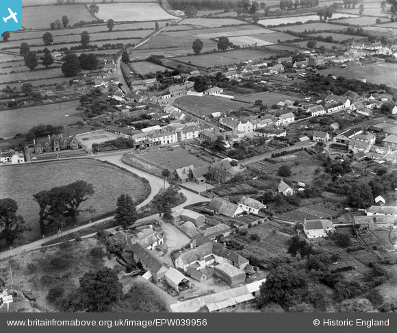
EPW039956 ENGLAND (1932). Bridge Farm and the village, Williton, 1932
© Copyright OpenStreetMap contributors and licensed by the OpenStreetMap Foundation. 2025. Cartography is licensed as CC BY-SA.
Nearby Images (5)
EPW039956

EPW033364

EPW033362

EPW039958

EPW039957

Details
| Title | [EPW039956] Bridge Farm and the village, Williton, 1932 |
| Reference | EPW039956 |
| Date | August-1932 |
| Link | |
| Place name | WILLITON |
| Parish | WILLITON |
| District | |
| Country | ENGLAND |
| Easting / Northing | 307702, 140893 |
| Longitude / Latitude | -3.3200324655961, 51.159311508848 |
| National Grid Reference | ST077409 |
Pins

dave |
Sunday 8th of January 2023 08:56:49 PM | |
|
dave |
Sunday 8th of January 2023 08:56:01 PM | |
|
dave |
Sunday 8th of January 2023 08:54:19 PM | |
|
Toby Clempson |
Wednesday 24th of July 2013 07:19:33 AM | |
|
Toby Clempson |
Wednesday 24th of July 2013 07:19:05 AM | |
|
Toby Clempson |
Wednesday 24th of July 2013 07:18:08 AM |