
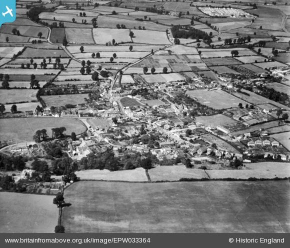
EPW033364 ENGLAND (1930). The town, Williton, 1930. This image has been produced from a copy-negative.
© Copyright OpenStreetMap contributors and licensed by the OpenStreetMap Foundation. 2025. Cartography is licensed as CC BY-SA.
Nearby Images (5)
EPW033364

EPW039956

EPW039958

EPW033362

EPW039957

Details
| Title | [EPW033364] The town, Williton, 1930. This image has been produced from a copy-negative. |
| Reference | EPW033364 |
| Date | July-1930 |
| Link | |
| Place name | WILLITON |
| Parish | WILLITON |
| District | |
| Country | ENGLAND |
| Easting / Northing | 307763, 140975 |
| Longitude / Latitude | -3.319181329595, 51.160058581682 |
| National Grid Reference | ST078410 |
Pins
Be the first to add a comment to this image!