
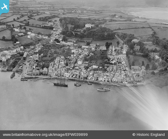
EPW039899 ENGLAND (1932). The village, the waterfront and surrounding countryside, Appledore, 1932
© Copyright OpenStreetMap contributors and licensed by the OpenStreetMap Foundation. 2026. Cartography is licensed as CC BY-SA.
Nearby Images (5)
EPW039899

EPW039898

EPW039896

EPW059622

EAW021340

Details
| Title | [EPW039899] The village, the waterfront and surrounding countryside, Appledore, 1932 |
| Reference | EPW039899 |
| Date | August-1932 |
| Link | |
| Place name | APPLEDORE |
| Parish | NORTHAM |
| District | |
| Country | ENGLAND |
| Easting / Northing | 246476, 130490 |
| Longitude / Latitude | -4.1907015751072, 51.052671964895 |
| National Grid Reference | SS465305 |
Pins
Be the first to add a comment to this image!