
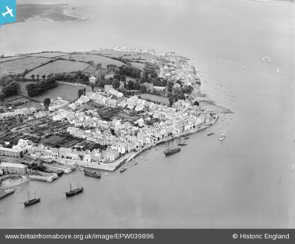
EPW039896 ENGLAND (1932). The village and waterfront, Appledore, 1932
© Copyright OpenStreetMap contributors and licensed by the OpenStreetMap Foundation. 2026. Cartography is licensed as CC BY-SA.
Nearby Images (5)
EPW039896

EPW039899

EPW039898

EPW059622

EAW021340

Details
| Title | [EPW039896] The village and waterfront, Appledore, 1932 |
| Reference | EPW039896 |
| Date | August-1932 |
| Link | |
| Place name | APPLEDORE |
| Parish | NORTHAM |
| District | |
| Country | ENGLAND |
| Easting / Northing | 246468, 130546 |
| Longitude / Latitude | -4.1908393977934, 51.053173076392 |
| National Grid Reference | SS465305 |
Pins

JAYWYNNE |
Sunday 7th of February 2021 02:37:32 PM | |
|
Kentishman |
Wednesday 3rd of August 2016 07:07:27 AM | |
|
Kentishman |
Wednesday 3rd of August 2016 06:45:20 AM | |
|
Kentishman |
Wednesday 3rd of August 2016 06:43:01 AM | |
|
Kentishman |
Wednesday 3rd of August 2016 06:33:52 AM |