
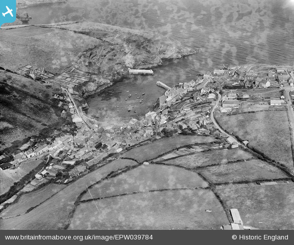
EPW039784 ENGLAND (1932). The village and The Haven, Port Isaac, 1932. This image has been produced from a damaged negative.
© Copyright OpenStreetMap contributors and licensed by the OpenStreetMap Foundation. 2026. Cartography is licensed as CC BY-SA.
Nearby Images (7)
EPW039784

EPW033107

EPW033106

EPW039783

EPW033102

EPW039782

EPW033105

Details
| Title | [EPW039784] The village and The Haven, Port Isaac, 1932. This image has been produced from a damaged negative. |
| Reference | EPW039784 |
| Date | August-1932 |
| Link | |
| Place name | PORT ISAAC |
| Parish | ST. ENDELLION |
| District | |
| Country | ENGLAND |
| Easting / Northing | 199668, 80816 |
| Longitude / Latitude | -4.830716843459, 50.592059019714 |
| National Grid Reference | SW997808 |
Pins
Be the first to add a comment to this image!