
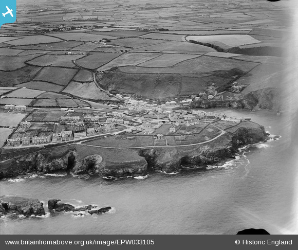
EPW033105 ENGLAND (1930). The village and surrounding countryside, Port Isaac, from the north-east, 1930
© Copyright OpenStreetMap contributors and licensed by the OpenStreetMap Foundation. 2026. Cartography is licensed as CC BY-SA.
Nearby Images (8)
EPW033105

EPW039782

EPW033102

EPW039783

EPW039785

EPW033106

EPW033107

EPW039784

Details
| Title | [EPW033105] The village and surrounding countryside, Port Isaac, from the north-east, 1930 |
| Reference | EPW033105 |
| Date | July-1930 |
| Link | |
| Place name | PORT ISAAC |
| Parish | ST. ENDELLION |
| District | |
| Country | ENGLAND |
| Easting / Northing | 199893, 81057 |
| Longitude / Latitude | -4.8276714828692, 50.59430108204 |
| National Grid Reference | SW999811 |
Pins

NicVic |
Saturday 4th of September 2021 10:22:14 AM |