
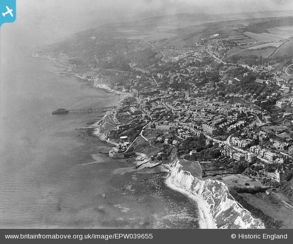
EPW039655 ENGLAND (1932). The town and coastline, Ventnor, from the east, 1932
© Copyright OpenStreetMap contributors and licensed by the OpenStreetMap Foundation. 2026. Cartography is licensed as CC BY-SA.
Nearby Images (4)
EPW039655

EPW000500

EAW038591

EAW038590

Details
| Title | [EPW039655] The town and coastline, Ventnor, from the east, 1932 |
| Reference | EPW039655 |
| Date | 12-August-1932 |
| Link | |
| Place name | VENTNOR |
| Parish | VENTNOR |
| District | |
| Country | ENGLAND |
| Easting / Northing | 456920, 77520 |
| Longitude / Latitude | -1.1957374745563, 50.594040769513 |
| National Grid Reference | SZ569775 |
Pins

flubber |
Monday 1st of September 2014 01:35:45 PM |