
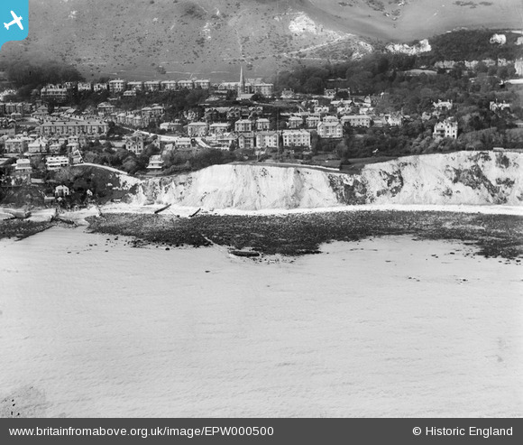
EPW000500 ENGLAND (1920). Ventnor, Isle of Wight, 1920
© Copyright OpenStreetMap contributors and licensed by the OpenStreetMap Foundation. 2026. Cartography is licensed as CC BY-SA.
Nearby Images (5)
EPW000500

EAW038590

EAW038591

EPW039655

EPW043016

Details
| Title | [EPW000500] Ventnor, Isle of Wight, 1920 |
| Reference | EPW000500 |
| Date | April-1920 |
| Link | |
| Place name | VENTNOR |
| Parish | VENTNOR |
| District | |
| Country | ENGLAND |
| Easting / Northing | 457079, 77582 |
| Longitude / Latitude | -1.1934815612324, 50.594582805024 |
| National Grid Reference | SZ571776 |
Pins
Be the first to add a comment to this image!