
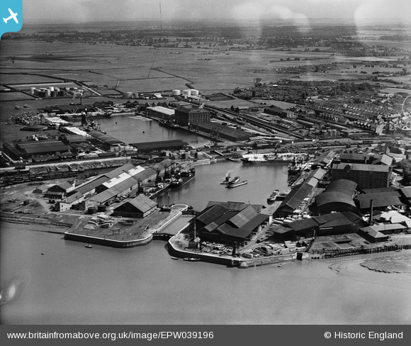
EPW039196 ENGLAND (1932). Alexandra Dock and Bentinck Dock, King's Lynn, 1932
© Copyright OpenStreetMap contributors and licensed by the OpenStreetMap Foundation. 2026. Cartography is licensed as CC BY-SA.
Nearby Images (18)
EPW039196

EPW043358

EPW034698

EPW021483

EPW043355

EPW021482

EPW043356

EPW021481

EPW043353

EAW044458

EPW034696

EPW031685

EPW043359

EPW043354

EPW031686

EPW043357

EPW043360

EPW031688

Details
| Title | [EPW039196] Alexandra Dock and Bentinck Dock, King's Lynn, 1932 |
| Reference | EPW039196 |
| Date | July-1932 |
| Link | |
| Place name | KING'S LYNN |
| Parish | |
| District | |
| Country | ENGLAND |
| Easting / Northing | 561655, 320715 |
| Longitude / Latitude | 0.39591925799281, 52.759481651391 |
| National Grid Reference | TF617207 |
Pins
Be the first to add a comment to this image!