
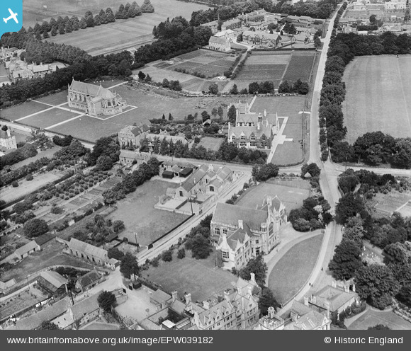
EPW039182 ENGLAND (1932). Oundle School, Oundle, 1932
© Copyright OpenStreetMap contributors and licensed by the OpenStreetMap Foundation. 2026. Cartography is licensed as CC BY-SA.
Nearby Images (6)
EPW039182

EPW039177

EPW039181

EAW015473

EAW016516

EAW016513

Details
| Title | [EPW039182] Oundle School, Oundle, 1932 |
| Reference | EPW039182 |
| Date | July-1932 |
| Link | |
| Place name | OUNDLE |
| Parish | OUNDLE |
| District | |
| Country | ENGLAND |
| Easting / Northing | 503976, 288294 |
| Longitude / Latitude | -0.46872859569747, 52.482280264288 |
| National Grid Reference | TL040883 |
Pins

MrNCWilson |
Monday 18th of November 2013 07:13:24 PM | |
|
MrNCWilson |
Monday 18th of November 2013 07:12:56 PM | |
|
MrNCWilson |
Monday 18th of November 2013 07:12:27 PM | |
|
MrNCWilson |
Monday 18th of November 2013 07:11:56 PM | |
|
MrNCWilson |
Monday 18th of November 2013 07:11:29 PM |