
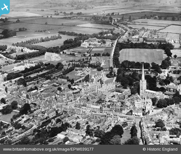
EPW039177 ENGLAND (1932). The town centre, Oundle, 1932. This image has been produced from a copy-negative.
© Copyright OpenStreetMap contributors and licensed by the OpenStreetMap Foundation. 2026. Cartography is licensed as CC BY-SA.
Nearby Images (6)
EPW039177

EPW039182

EAW015473

EAW016516

EAW016513

EPW039181

Details
| Title | [EPW039177] The town centre, Oundle, 1932. This image has been produced from a copy-negative. |
| Reference | EPW039177 |
| Date | July-1932 |
| Link | |
| Place name | OUNDLE |
| Parish | OUNDLE |
| District | |
| Country | ENGLAND |
| Easting / Northing | 504027, 288241 |
| Longitude / Latitude | -0.46799435333283, 52.481794190197 |
| National Grid Reference | TL040882 |
Pins
Be the first to add a comment to this image!