
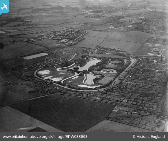
EPW038963 ENGLAND (1932). Queen's Park and environs, Blackburn, 1932
© Copyright OpenStreetMap contributors and licensed by the OpenStreetMap Foundation. 2026. Cartography is licensed as CC BY-SA.
Nearby Images (7)
EPW038963

EPW038967

EPW013378

EPW038965

EPW038966

EPW038964

EPW013925

Details
| Title | [EPW038963] Queen's Park and environs, Blackburn, 1932 |
| Reference | EPW038963 |
| Date | July-1932 |
| Link | |
| Place name | BLACKBURN |
| Parish | |
| District | |
| Country | ENGLAND |
| Easting / Northing | 369740, 427183 |
| Longitude / Latitude | -2.4588264813595, 53.739929430786 |
| National Grid Reference | SD697272 |
Pins
Be the first to add a comment to this image!