
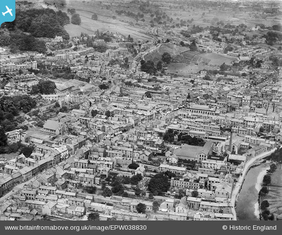
EPW038830 ENGLAND (1932). Highgate and the town centre, Kendal, 1932
© Copyright OpenStreetMap contributors and licensed by the OpenStreetMap Foundation. 2026. Cartography is licensed as CC BY-SA.
Nearby Images (9)
EPW038830

EAW043384

EAW043385

EPW038828

EPW026547

EPW026543

EAW014500

EPW038827

EPW026545

Details
| Title | [EPW038830] Highgate and the town centre, Kendal, 1932 |
| Reference | EPW038830 |
| Date | July-1932 |
| Link | |
| Place name | KENDAL |
| Parish | KENDAL |
| District | |
| Country | ENGLAND |
| Easting / Northing | 351432, 492581 |
| Longitude / Latitude | -2.7468675925282, 54.326336536402 |
| National Grid Reference | SD514926 |
Pins

iain noble |
Friday 5th of October 2018 11:55:15 AM | |
|
alastair wallace |
Wednesday 18th of November 2015 08:30:11 PM |