
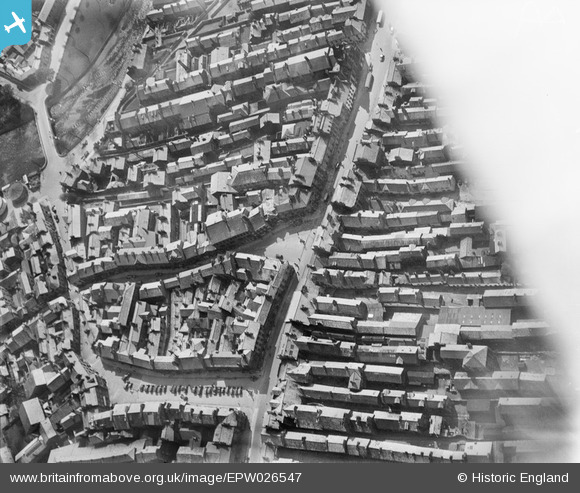
EPW026547 ENGLAND (1929). The junction of Finkle Street and Strickland Gate, Kendal, 1929
© Copyright OpenStreetMap contributors and licensed by the OpenStreetMap Foundation. 2026. Cartography is licensed as CC BY-SA.
Nearby Images (11)
EPW026547

EPW026543

EAW043384

EPW026539

EPW038830

EAW043385

EPW038827

EAW043383

EPW038828

EAW014500

EPW026540

Details
| Title | [EPW026547] The junction of Finkle Street and Strickland Gate, Kendal, 1929 |
| Reference | EPW026547 |
| Date | May-1929 |
| Link | |
| Place name | KENDAL |
| Parish | KENDAL |
| District | |
| Country | ENGLAND |
| Easting / Northing | 351506, 492718 |
| Longitude / Latitude | -2.7457520192206, 54.327574855869 |
| National Grid Reference | SD515927 |
Pins

Northern Harlequin |
Friday 6th of November 2020 11:39:13 PM | |
|
Northern Harlequin |
Friday 6th of November 2020 11:38:05 PM |