
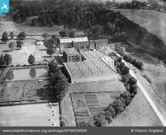
EPW038668 ENGLAND (1932). Low Mill, Addingham, 1932
© Copyright OpenStreetMap contributors and licensed by the OpenStreetMap Foundation. 2025. Cartography is licensed as CC BY-SA.
Nearby Images (7)
EPW038668

EPW038670

EPW038671

EPW038672

EPW024397

EPW024396

EPW038667

Details
| Title | [EPW038668] Low Mill, Addingham, 1932 |
| Reference | EPW038668 |
| Date | June-1932 |
| Link | |
| Place name | ADDINGHAM |
| Parish | ADDINGHAM |
| District | |
| Country | ENGLAND |
| Easting / Northing | 409077, 449210 |
| Longitude / Latitude | -1.8617141766979, 53.938727662576 |
| National Grid Reference | SE091492 |
Pins
Be the first to add a comment to this image!