
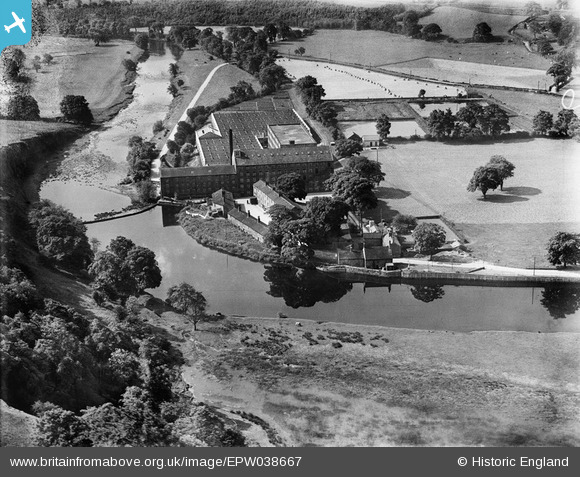
EPW038667 ENGLAND (1932). Low Mill and the River Wharfe, Addingham, 1932
© Copyright OpenStreetMap contributors and licensed by the OpenStreetMap Foundation. 2025. Cartography is licensed as CC BY-SA.
Nearby Images (7)
EPW038667

EPW024396

EPW024397

EPW038670

EPW038671

EPW038672

EPW038668

Details
| Title | [EPW038667] Low Mill and the River Wharfe, Addingham, 1932 |
| Reference | EPW038667 |
| Date | June-1932 |
| Link | |
| Place name | ADDINGHAM |
| Parish | ADDINGHAM |
| District | |
| Country | ENGLAND |
| Easting / Northing | 409096, 449380 |
| Longitude / Latitude | -1.8614196534668, 53.940255420631 |
| National Grid Reference | SE091494 |
Pins

Simon |
Friday 29th of January 2021 06:34:51 PM | |
|
MB |
Sunday 30th of December 2012 10:59:53 AM | |
|
MB |
Sunday 30th of December 2012 10:59:10 AM | |
|
MB |
Sunday 30th of December 2012 10:55:10 AM | |
|
MB |
Sunday 30th of December 2012 10:52:09 AM | |
LMS Skipton and Ilkley branch line |
MB |
Sunday 30th of December 2012 11:03:54 AM |
User Comment Contributions
Just out of shot above the cliff on the left is the site of Castleberg, a Roman camp, marked on the Ordnance Survey map of 1909. A Roman road ran south from the camp, alongside the River Wharfe |
MB |
Sunday 30th of December 2012 10:58:50 AM |
Low Mill was a silk mill in 1909 |
MB |
Sunday 30th of December 2012 10:55:37 AM |