
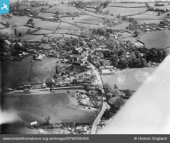
EPW038494 ENGLAND (1932). St James's Church and the village, Audlem, 1932
© Copyright OpenStreetMap contributors and licensed by the OpenStreetMap Foundation. 2025. Cartography is licensed as CC BY-SA.
Nearby Images (6)
EPW038494

EPW038496

EPW034220

EPW034217

EPW038495

EPW034218

Details
| Title | [EPW038494] St James's Church and the village, Audlem, 1932 |
| Reference | EPW038494 |
| Date | June-1932 |
| Link | |
| Place name | AUDLEM |
| Parish | AUDLEM |
| District | |
| Country | ENGLAND |
| Easting / Northing | 365943, 343598 |
| Longitude / Latitude | -2.5073912662437, 52.988323891719 |
| National Grid Reference | SJ659436 |
Pins

Earthshaker |
Tuesday 15th of November 2016 02:35:44 PM |