
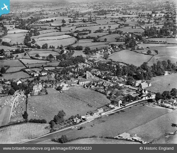
EPW034220 ENGLAND (1930). The village and surrounding countryside, Audlem, from the west, 1930
© Copyright OpenStreetMap contributors and licensed by the OpenStreetMap Foundation. 2025. Cartography is licensed as CC BY-SA.
Nearby Images (6)
EPW034220

EPW038496

EPW038494

EPW034218

EPW034217

EPW038495

Details
| Title | [EPW034220] The village and surrounding countryside, Audlem, from the west, 1930 |
| Reference | EPW034220 |
| Date | July-1930 |
| Link | |
| Place name | AUDLEM |
| Parish | AUDLEM |
| District | |
| Country | ENGLAND |
| Easting / Northing | 365896, 343647 |
| Longitude / Latitude | -2.5080966254072, 52.988761405933 |
| National Grid Reference | SJ659436 |
Pins

Earthshaker |
Tuesday 15th of November 2016 02:34:36 PM | |
|
Nigel Mottershead |
Monday 21st of September 2015 04:23:13 PM | |
|
Nigel Mottershead |
Monday 21st of September 2015 04:22:10 PM | |
|
Nigel Mottershead |
Monday 21st of September 2015 04:06:05 PM | |
|
cvb |
Wednesday 8th of October 2014 04:34:24 PM | |
|
cvb |
Wednesday 8th of October 2014 04:33:33 PM | |
|
cvb |
Wednesday 8th of October 2014 04:32:53 PM |