
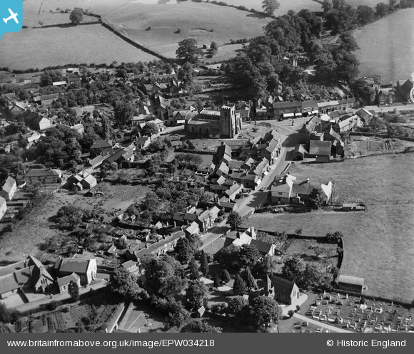
EPW034218 ENGLAND (1930). St James's Church and the village, Audlem, 1930
© Copyright OpenStreetMap contributors and licensed by the OpenStreetMap Foundation. 2025. Cartography is licensed as CC BY-SA.
Nearby Images (6)
EPW034218

EPW034217

EPW038495

EPW034220

EPW038496

EPW038494

Details
| Title | [EPW034218] St James's Church and the village, Audlem, 1930 |
| Reference | EPW034218 |
| Date | July-1930 |
| Link | |
| Place name | AUDLEM |
| Parish | AUDLEM |
| District | |
| Country | ENGLAND |
| Easting / Northing | 365979, 343699 |
| Longitude / Latitude | -2.506865579844, 52.989234157234 |
| National Grid Reference | SJ660437 |
Pins

cvb |
Wednesday 8th of October 2014 04:38:32 PM |