
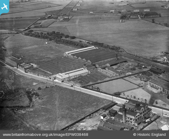
EPW038468 ENGLAND (1932). The Churchill Machine Tool Works, Broadheath, 1932. This image has been produced from a print.
© Copyright OpenStreetMap contributors and licensed by the OpenStreetMap Foundation. 2026. Cartography is licensed as CC BY-SA.
Nearby Images (16)
EPW038468

EPW050673

EPW038470

EPW050021

EPW050670

EPW050671

EPW050672

EAW031523

EAW031526

EAW031522

EAW031528

EAW031524

EAW031521

EAW031527

EAW031525

EAW031529

Details
| Title | [EPW038468] The Churchill Machine Tool Works, Broadheath, 1932. This image has been produced from a print. |
| Reference | EPW038468 |
| Date | June-1932 |
| Link | |
| Place name | BROADHEATH |
| Parish | |
| District | |
| Country | ENGLAND |
| Easting / Northing | 375967, 389072 |
| Longitude / Latitude | -2.3614768043824, 53.39766714826 |
| National Grid Reference | SJ760891 |
Pins

parrot |
Wednesday 25th of December 2019 11:05:03 PM | |
|
Jan S |
Thursday 13th of November 2014 09:16:47 PM | |
|
Jan S |
Thursday 13th of November 2014 09:13:44 PM | |
|
Jan S |
Thursday 13th of November 2014 09:12:05 PM | |
|
Jan S |
Thursday 13th of November 2014 09:09:40 PM |