
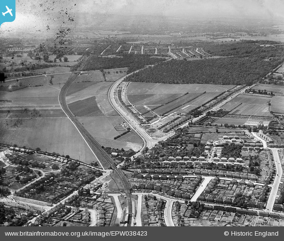
EPW038423 ENGLAND (1932). New housing site alongside Welling Way, Oxleas Wood and Bellegrove Road, Welling, from the north-east, 1932
© Copyright OpenStreetMap contributors and licensed by the OpenStreetMap Foundation. 2026. Cartography is licensed as CC BY-SA.
Nearby Images (9)
EPW038423

EPW038208

EPW038186

EPW038190

EPW038213

EPW038209

EPW038421

EPW038188

EPW038191

Details
| Title | [EPW038423] New housing site alongside Welling Way, Oxleas Wood and Bellegrove Road, Welling, from the north-east, 1932 |
| Reference | EPW038423 |
| Date | 14-June-1932 |
| Link | |
| Place name | WELLING |
| Parish | |
| District | |
| Country | ENGLAND |
| Easting / Northing | 545740, 176023 |
| Longitude / Latitude | 0.098263487620915, 51.463900703344 |
| National Grid Reference | TQ457760 |
Pins

Steve Camp |
Tuesday 10th of September 2019 12:17:50 PM | |
|
Steve Camp |
Tuesday 10th of September 2019 12:16:31 PM | |
|
Steve Camp |
Tuesday 10th of September 2019 12:15:19 PM |