
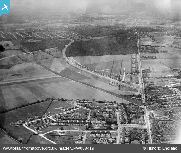
EPW038419 ENGLAND (1932). New housing site alongside Welling Way, Oxleas Wood and Bellegrove Road, Welling, from the east, 1932
© Copyright OpenStreetMap contributors and licensed by the OpenStreetMap Foundation. 2026. Cartography is licensed as CC BY-SA.
Nearby Images (7)
EPW038419

EPW038418

EPW038209

EPW038190

EPW038421

EPW038186

EPW038208

Details
| Title | [EPW038419] New housing site alongside Welling Way, Oxleas Wood and Bellegrove Road, Welling, from the east, 1932 |
| Reference | EPW038419 |
| Date | 14-June-1932 |
| Link | |
| Place name | WELLING |
| Parish | |
| District | |
| Country | ENGLAND |
| Easting / Northing | 545777, 175752 |
| Longitude / Latitude | 0.098684046543825, 51.461455824451 |
| National Grid Reference | TQ458758 |
Pins

MR G A J REID |
Tuesday 1st of December 2020 12:13:53 PM |