
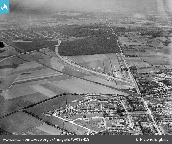
EPW038418 ENGLAND (1932). New housing site alongside Welling Way, Oxleas Wood and Bellegrove Road, Welling, from the east, 1932
© Copyright OpenStreetMap contributors and licensed by the OpenStreetMap Foundation. 2026. Cartography is licensed as CC BY-SA.
Nearby Images (5)
EPW038418

EPW038419

EPW038209

EPW038190

EPW038421

Details
| Title | [EPW038418] New housing site alongside Welling Way, Oxleas Wood and Bellegrove Road, Welling, from the east, 1932 |
| Reference | EPW038418 |
| Date | 14-June-1932 |
| Link | |
| Place name | WELLING |
| Parish | |
| District | |
| Country | ENGLAND |
| Easting / Northing | 545755, 175691 |
| Longitude / Latitude | 0.098342401365471, 51.46091331256 |
| National Grid Reference | TQ458757 |
Pins
Be the first to add a comment to this image!