
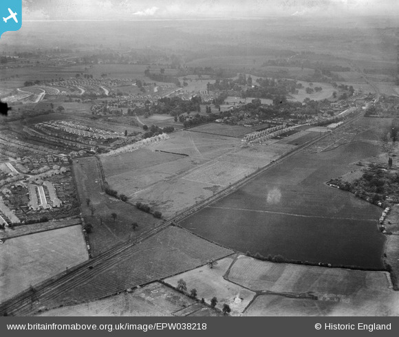
EPW038218 ENGLAND (1932). The Dartford Loop Railway Link and construction of new housing around Old Farm Avenue and environs, Sidcup, from the west, 1932
© Copyright OpenStreetMap contributors and licensed by the OpenStreetMap Foundation. 2026. Cartography is licensed as CC BY-SA.
Nearby Images (5)
EPW038218

EPW038216

EPW038220

EPW035579

EPW044390

Details
| Title | [EPW038218] The Dartford Loop Railway Link and construction of new housing around Old Farm Avenue and environs, Sidcup, from the west, 1932 |
| Reference | EPW038218 |
| Date | June-1932 |
| Link | |
| Place name | SIDCUP |
| Parish | |
| District | |
| Country | ENGLAND |
| Easting / Northing | 544800, 172800 |
| Longitude / Latitude | 0.083420448904052, 51.435178105908 |
| National Grid Reference | TQ448728 |
Pins
Be the first to add a comment to this image!