
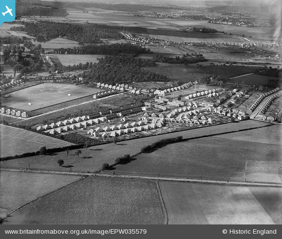
EPW035579 ENGLAND (1931). Housing surrounding Valliers Wood Road, Longlands, 1931
© Copyright OpenStreetMap contributors and licensed by the OpenStreetMap Foundation. 2026. Cartography is licensed as CC BY-SA.
Nearby Images (4)
EPW035579

EPW038216

EPW038220

EPW038218

Details
| Title | [EPW035579] Housing surrounding Valliers Wood Road, Longlands, 1931 |
| Reference | EPW035579 |
| Date | June-1931 |
| Link | |
| Place name | LONGLANDS |
| Parish | |
| District | |
| Country | ENGLAND |
| Easting / Northing | 544999, 172921 |
| Longitude / Latitude | 0.086331230019301, 51.436214585618 |
| National Grid Reference | TQ450729 |
Pins

R |
Tuesday 12th of December 2017 08:10:03 AM | |
|
billybuttons |
Saturday 4th of January 2014 09:29:23 PM | |
|
billybuttons |
Saturday 4th of January 2014 09:28:05 PM |