
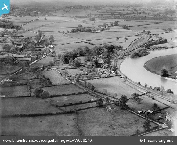
EPW038176 ENGLAND (1932). The village, Clifford Castle and surrounding countryside, Clifford, 1932
© Copyright OpenStreetMap contributors and licensed by the OpenStreetMap Foundation. 2025. Cartography is licensed as CC BY-SA.
Nearby Images (7)
EPW038176

EPW038177

EAW007988

EAW007986

EAW007984

EAW007985

EAW007987

Details
| Title | [EPW038176] The village, Clifford Castle and surrounding countryside, Clifford, 1932 |
| Reference | EPW038176 |
| Date | May-1932 |
| Link | |
| Place name | CLIFFORD |
| Parish | CLIFFORD |
| District | |
| Country | ENGLAND |
| Easting / Northing | 324494, 245790 |
| Longitude / Latitude | -3.1025607397576, 52.1048691546 |
| National Grid Reference | SO245458 |
