
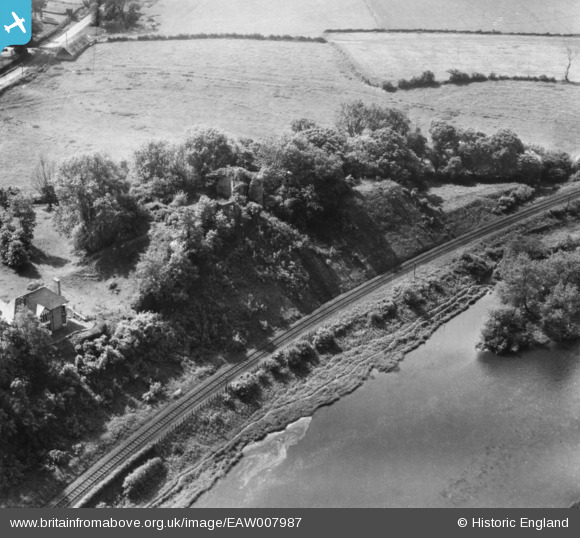
EAW007987 ENGLAND (1947). The remains of Clifford Castle, Clifford, 1947. This image has been produced from a print.
© Copyright OpenStreetMap contributors and licensed by the OpenStreetMap Foundation. 2025. Cartography is licensed as CC BY-SA.
Nearby Images (6)
EAW007987

EAW007986

EAW007988

EAW007985

EAW007984

EPW038176

Details
| Title | [EAW007987] The remains of Clifford Castle, Clifford, 1947. This image has been produced from a print. |
| Reference | EAW007987 |
| Date | 30-June-1947 |
| Link | |
| Place name | CLIFFORD |
| Parish | CLIFFORD |
| District | |
| Country | ENGLAND |
| Easting / Northing | 324343, 245701 |
| Longitude / Latitude | -3.1047454700492, 52.104048415555 |
| National Grid Reference | SO243457 |
Pins
Be the first to add a comment to this image!