
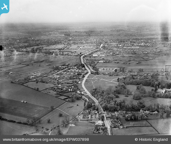
EPW037898 ENGLAND (1932). The village and surrounding countryside with Bedford in the distance, Goldington, from the east, 1932
© Copyright OpenStreetMap contributors and licensed by the OpenStreetMap Foundation. 2026. Cartography is licensed as CC BY-SA.
Nearby Images (4)
EPW037898

EPW037897

EPW037896

EPW037895

Details
| Title | [EPW037898] The village and surrounding countryside with Bedford in the distance, Goldington, from the east, 1932 |
| Reference | EPW037898 |
| Date | May-1932 |
| Link | |
| Place name | GOLDINGTON |
| Parish | |
| District | |
| Country | ENGLAND |
| Easting / Northing | 507765, 250616 |
| Longitude / Latitude | -0.4250187711758, 52.142901317827 |
| National Grid Reference | TL078506 |
Pins

melgibbs |
Friday 29th of August 2014 11:52:45 AM | |
|
melgibbs |
Sunday 8th of December 2013 04:36:21 PM | |
|
melgibbs |
Sunday 8th of December 2013 04:35:16 PM | |
|
melgibbs |
Saturday 15th of June 2013 06:35:15 PM | |
|
melgibbs |
Saturday 15th of June 2013 06:34:24 PM |
User Comment Contributions

Although not very clear in this image, the memorial base has been changed and has the names of local soldiers killed on both World Wars. Being on a busy road it is often overlooked. |
melgibbs |
Friday 29th of August 2014 12:00:15 PM |