
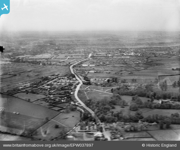
EPW037897 ENGLAND (1932). The village and surrounding countryside with Bedford in the distance, Goldington, from the east, 1932
© Copyright OpenStreetMap contributors and licensed by the OpenStreetMap Foundation. 2026. Cartography is licensed as CC BY-SA.
Nearby Images (3)
EPW037897

EPW037898

EPW037896

Details
| Title | [EPW037897] The village and surrounding countryside with Bedford in the distance, Goldington, from the east, 1932 |
| Reference | EPW037897 |
| Date | May-1932 |
| Link | |
| Place name | GOLDINGTON |
| Parish | |
| District | |
| Country | ENGLAND |
| Easting / Northing | 507683, 250633 |
| Longitude / Latitude | -0.42621132081671, 52.143070109958 |
| National Grid Reference | TL077506 |
Pins

melgibbs |
Friday 29th of August 2014 11:55:17 AM | |
|
melgibbs |
Sunday 8th of December 2013 04:43:03 PM | |
|
melgibbs |
Sunday 8th of December 2013 04:42:43 PM | |
|
melgibbs |
Sunday 8th of December 2013 04:42:24 PM |