
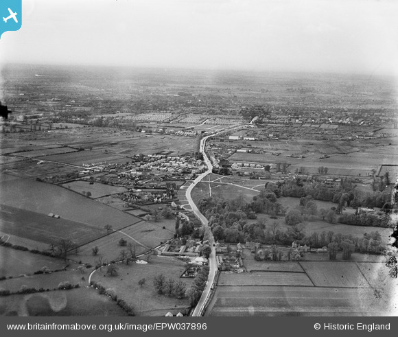
EPW037896 ENGLAND (1932). The village and surrounding countryside with Bedford in the distance, Goldington, from the east, 1932
© Copyright OpenStreetMap contributors and licensed by the OpenStreetMap Foundation. 2026. Cartography is licensed as CC BY-SA.
Nearby Images (4)
EPW037896

EPW037895

EPW037898

EPW037897

Details
| Title | [EPW037896] The village and surrounding countryside with Bedford in the distance, Goldington, from the east, 1932 |
| Reference | EPW037896 |
| Date | May-1932 |
| Link | |
| Place name | GOLDINGTON |
| Parish | |
| District | |
| Country | ENGLAND |
| Easting / Northing | 507869, 250680 |
| Longitude / Latitude | -0.42347912078089, 52.143456254638 |
| National Grid Reference | TL079507 |
Pins

melgibbs |
Friday 29th of August 2014 11:54:38 AM | |
|
melgibbs |
Sunday 8th of December 2013 04:41:38 PM | |
|
melgibbs |
Sunday 8th of December 2013 04:41:16 PM | |
|
melgibbs |
Sunday 8th of December 2013 04:40:42 PM |