
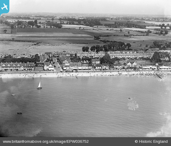
EPW036752 ENGLAND (1931). The seafront and the Eastern Esplanade, Southend-on-Sea, from the south, 1931
© Copyright OpenStreetMap contributors and licensed by the OpenStreetMap Foundation. 2026. Cartography is licensed as CC BY-SA.
Nearby Images (5)
EPW036752

EPW036753

EPW036751

EPW024872

EPW036701

Details
| Title | [EPW036752] The seafront and the Eastern Esplanade, Southend-on-Sea, from the south, 1931 |
| Reference | EPW036752 |
| Date | September-1931 |
| Link | |
| Place name | SOUTHEND-ON-SEA |
| Parish | |
| District | |
| Country | ENGLAND |
| Easting / Northing | 590392, 184731 |
| Longitude / Latitude | 0.74513099679754, 51.528860232761 |
| National Grid Reference | TQ904847 |
Pins

eagle |
Tuesday 25th of February 2014 01:45:57 PM | |

Maurice |
Wednesday 17th of April 2013 08:28:42 AM | |
Southend's tramway system ran on the 3ft 6inch gauge, opened in 1901; the extension along the Eastern Esplanade was opened 1908. From 1928 onwards trams were displaced by trolleybuses, or by motor buses as track renewals became due. The final routes were closed in 1942. |
John W |
Tuesday 28th of March 2017 10:43:27 AM |