
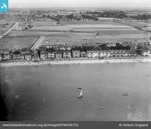
EPW036753 ENGLAND (1931). The seafront and the Eastern Esplanade, Southend-on-Sea, from the south, 1931
© Copyright OpenStreetMap contributors and licensed by the OpenStreetMap Foundation. 2026. Cartography is licensed as CC BY-SA.
Nearby Images (5)
EPW036753

EPW036752

EPW036701

EPW036754

EPW040979

Details
| Title | [EPW036753] The seafront and the Eastern Esplanade, Southend-on-Sea, from the south, 1931 |
| Reference | EPW036753 |
| Date | September-1931 |
| Link | |
| Place name | SOUTHEND-ON-SEA |
| Parish | |
| District | |
| Country | ENGLAND |
| Easting / Northing | 590223, 184711 |
| Longitude / Latitude | 0.74268650486853, 51.528737549232 |
| National Grid Reference | TQ902847 |
Pins

Floss63 |
Tuesday 19th of May 2026 07:20:58 PM | |
|
Floss63 |
Wednesday 11th of September 2024 12:49:19 PM | |
|
Floss63 |
Tuesday 11th of June 2024 08:53:53 PM | |
|
Floss63 |
Tuesday 11th of June 2024 08:52:40 PM | |
|
Sara |
Friday 19th of January 2024 05:39:48 PM | |
|
GT54 |
Wednesday 1st of July 2020 11:23:23 AM | |
|
GT54 |
Wednesday 1st of July 2020 11:22:41 AM | |
|
GT54 |
Wednesday 1st of July 2020 11:21:37 AM | |

Maurice |
Wednesday 1st of May 2013 05:45:19 PM | |
Southend's tramway system ran on the 3ft 6inch gauge, opened in 1901; the extension along the Eastern Esplanade was opened 1908. From 1928 onwards trams were displaced by trolleybuses, or by motor buses as track renewals became due. The final routes were closed in 1942. |
John W |
Tuesday 28th of March 2017 10:41:36 AM |