
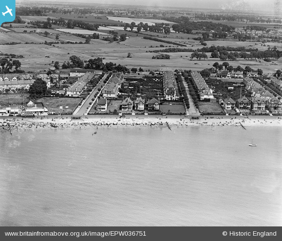
EPW036751 ENGLAND (1931). Housing along the seafront at Cliveden Road and Warwick Road, Thorpe Bay, from the south, 1931
© Copyright OpenStreetMap contributors and licensed by the OpenStreetMap Foundation. 2026. Cartography is licensed as CC BY-SA.
Nearby Images (6)
EPW036751

EPW024872

EPW040966

EPW036750

EPW036752

EPW036731

Details
| Title | [EPW036751] Housing along the seafront at Cliveden Road and Warwick Road, Thorpe Bay, from the south, 1931 |
| Reference | EPW036751 |
| Date | September-1931 |
| Link | |
| Place name | THORPE BAY |
| Parish | |
| District | |
| Country | ENGLAND |
| Easting / Northing | 590565, 184749 |
| Longitude / Latitude | 0.74763201983942, 51.528963550922 |
| National Grid Reference | TQ906847 |
Pins
Be the first to add a comment to this image!