
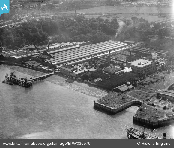
EPW036579 ENGLAND (1931). W.T. Henley's Electric Cable Works, Gravesend, from the north-west, 1931
© Copyright OpenStreetMap contributors and licensed by the OpenStreetMap Foundation. 2026. Cartography is licensed as CC BY-SA.
Nearby Images (21)
EPW036579

EPW036588

EPW036581

EPW032817

EPW032818

EPW036580

EAW031130

EPW036577

EPW032816

EAW031131

EAW031127

EAW031132

EPW036578

EAW028716

EAW031123

EAW028719

EAW031128

EAW031129

EAW031126

EAW031125

EAW028717

Details
| Title | [EPW036579] W.T. Henley's Electric Cable Works, Gravesend, from the north-west, 1931 |
| Reference | EPW036579 |
| Date | September-1931 |
| Link | |
| Place name | GRAVESEND |
| Parish | |
| District | |
| Country | ENGLAND |
| Easting / Northing | 563299, 174553 |
| Longitude / Latitude | 0.35017066205223, 51.445898630559 |
| National Grid Reference | TQ633746 |
Pins

Kentishman |
Sunday 29th of June 2014 04:59:56 PM |