
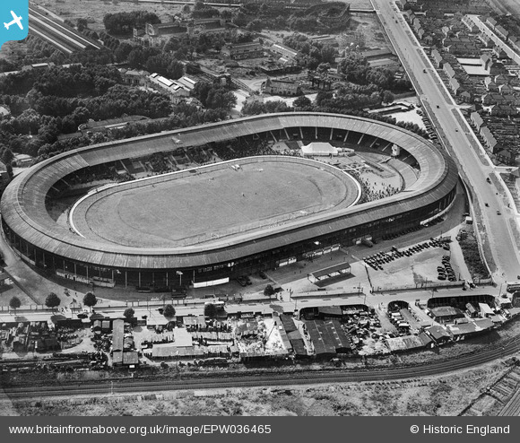
EPW036465 ENGLAND (1931). Shepherd's Bush, a greyhound race meeting in progress at the White City Stadium, 1931
© Copyright OpenStreetMap contributors and licensed by the OpenStreetMap Foundation. 2026. Cartography is licensed as CC BY-SA.
Nearby Images (48)
EPW036465

EPW031086

EPW036470

EPW054545

EPW054551

EPW036464

EPW036468

EPW054548

EPW036469

EPW042217
, 1933")
EPW031087

EPW046819

EPW054546

EPW031078

EPW054547

EPW031082

EPW031079

EPW053787

EPW054550

EPW031083

EPW031077

EPW042221
, 1933")
EPW022644

EPW054549

EPW031084

EPW036473

EPW022641

EPW022643

EPW022642

EPW036466

EPW053795

EPW056836

EPW053782

EPW031085

EPW053792

EPW022639

EPW031081

EPW042220
, 1933")
EPW042222
, 1933")
EPW042223
, 1933")
EPW022638

EPW021262

EPW021263

EPW019018

EPW042219
, 1933")
EAW005414

EPW062153

EAW005407

Details
| Title | [EPW036465] Shepherd's Bush, a greyhound race meeting in progress at the White City Stadium, 1931 |
| Reference | EPW036465 |
| Date | August-1931 |
| Link | |
| Place name | SHEPHERD'S BUSH |
| Parish | |
| District | |
| Country | ENGLAND |
| Easting / Northing | 523095, 180932 |
| Longitude / Latitude | -0.22586803951376, 51.513403453367 |
| National Grid Reference | TQ231809 |
Pins

Stu |
Sunday 27th of January 2013 12:13:33 AM |