
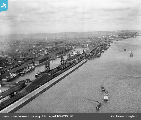
EPW036376 ENGLAND (1931). The Albert Dock, the Riverside Quay Clock Tower and the River Humber, Kingston upon Hull, from the south-west, 1931
© Copyright OpenStreetMap contributors and licensed by the OpenStreetMap Foundation. 2026. Cartography is licensed as CC BY-SA.
Nearby Images (4)
EPW036376

EPW036378

EPW010814

EPW009400

Details
| Title | [EPW036376] The Albert Dock, the Riverside Quay Clock Tower and the River Humber, Kingston upon Hull, from the south-west, 1931 |
| Reference | EPW036376 |
| Date | August-1931 |
| Link | |
| Place name | KINGSTON UPON HULL |
| Parish | |
| District | |
| Country | ENGLAND |
| Easting / Northing | 508671, 427371 |
| Longitude / Latitude | -0.35252253733137, 53.731173131643 |
| National Grid Reference | TA087274 |
Pins
Be the first to add a comment to this image!