
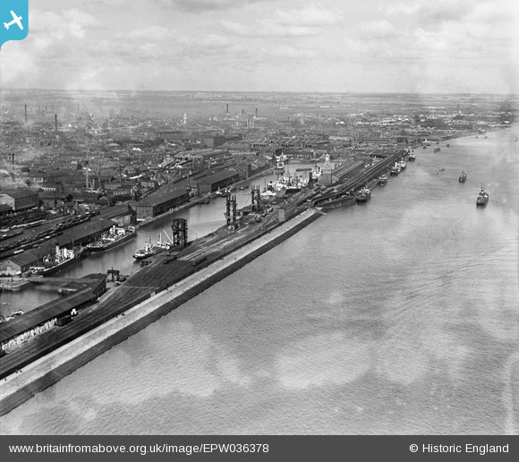
EPW036378 ENGLAND (1931). The Albert Dock and the River Humber, Kingston upon Hull, from the south, 1931
© Copyright OpenStreetMap contributors and licensed by the OpenStreetMap Foundation. 2026. Cartography is licensed as CC BY-SA.
Nearby Images (2)
EPW036378

EPW036376

Details
| Title | [EPW036378] The Albert Dock and the River Humber, Kingston upon Hull, from the south, 1931 |
| Reference | EPW036378 |
| Date | August-1931 |
| Link | |
| Place name | KINGSTON UPON HULL |
| Parish | |
| District | |
| Country | ENGLAND |
| Easting / Northing | 508553, 427255 |
| Longitude / Latitude | -0.35435134835081, 53.730155398513 |
| National Grid Reference | TA086273 |
Pins

John Wass |
Tuesday 4th of July 2017 03:49:36 PM |