
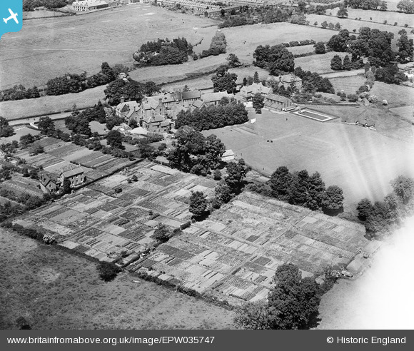
EPW035747 ENGLAND (1931). King's School, Warwick, 1931
© Copyright OpenStreetMap contributors and licensed by the OpenStreetMap Foundation. 2026. Cartography is licensed as CC BY-SA.
Nearby Images (4)
EPW035747

EPR000076

EPW035744

EPW035745

Details
| Title | [EPW035747] King's School, Warwick, 1931 |
| Reference | EPW035747 |
| Date | June-1931 |
| Link | |
| Place name | WARWICK |
| Parish | WARWICK |
| District | |
| Country | ENGLAND |
| Easting / Northing | 429164, 264549 |
| Longitude / Latitude | -1.572487444957, 52.277920988381 |
| National Grid Reference | SP292645 |
Pins
Be the first to add a comment to this image!
User Comment Contributions
A wonderful shot from the south west. This clearly shows the isolation of the school's sanatorium, seen to the extreme left of the photo. A shame about the glare in the bottom right-hand corner. |

Gervald Frykman |
Wednesday 22nd of June 2016 01:21:16 PM |