
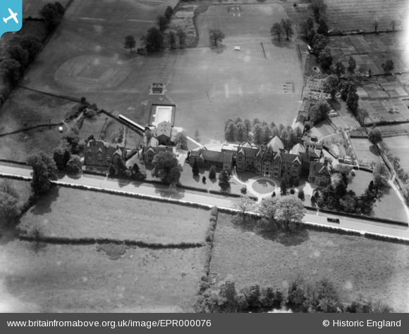
EPR000076 ENGLAND (1934). Warwick School, Warwick, from the north, 1934
© Copyright OpenStreetMap contributors and licensed by the OpenStreetMap Foundation. 2026. Cartography is licensed as CC BY-SA.
Nearby Images (4)
EPR000076

EPW035744

EPW035747

EPW035745

Details
| Title | [EPR000076] Warwick School, Warwick, from the north, 1934 |
| Reference | EPR000076 |
| Date | 1934 |
| Link | |
| Place name | WARWICK |
| Parish | WARWICK |
| District | |
| Country | ENGLAND |
| Easting / Northing | 429212, 264677 |
| Longitude / Latitude | -1.5717727458456, 52.279069295255 |
| National Grid Reference | SP292647 |
Pins
User Comment Contributions
Just one vehicle on the Myton Road! |

Gervald Frykman |
Wednesday 22nd of June 2016 01:23:26 PM |
Photo of Warwick School for boys, looking South East. |
Graeme |
Sunday 2nd of November 2014 04:46:58 AM |
A school, probably boys as there are cricket nets. |
TomRobin |
Friday 31st of October 2014 07:04:37 PM |