
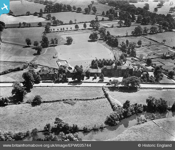
EPW035744 ENGLAND (1931). King's School, Warwick, 1931
© Copyright OpenStreetMap contributors and licensed by the OpenStreetMap Foundation. 2026. Cartography is licensed as CC BY-SA.
Nearby Images (4)
EPW035744

EPR000076

EPW035747

EPW035745

Details
| Title | [EPW035744] King's School, Warwick, 1931 |
| Reference | EPW035744 |
| Date | June-1931 |
| Link | |
| Place name | WARWICK |
| Parish | WARWICK |
| District | |
| Country | ENGLAND |
| Easting / Northing | 429218, 264675 |
| Longitude / Latitude | -1.5716849661175, 52.279050994165 |
| National Grid Reference | SP292647 |
Pins
User Comment Contributions
This clearly shows not only the school's kitchen garden, but also the allotments to the west of the school. |

Gervald Frykman |
Wednesday 22nd of June 2016 01:19:19 PM |