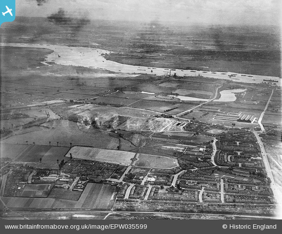
EPW035599 ENGLAND (1931). Dagenham Old Park and environs, Dagenham, from the north, 1931
© Copyright OpenStreetMap contributors and licensed by the OpenStreetMap Foundation. 2026. Cartography is licensed as CC BY-SA.
Details
| Title | [EPW035599] Dagenham Old Park and environs, Dagenham, from the north, 1931 |
| Reference | EPW035599 |
| Date | June-1931 |
| Link | |
| Place name | DAGENHAM |
| Parish | |
| District | |
| Country | ENGLAND |
| Easting / Northing | 549559, 184324 |
| Longitude / Latitude | 0.15672521281405, 51.537498233914 |
| National Grid Reference | TQ496843 |
Pins

Ken Stanton |
Sunday 9th of May 2021 04:45:56 PM | |

Ken Stanton |
Sunday 9th of May 2021 04:42:38 PM | |

Ken Stanton |
Sunday 9th of May 2021 04:40:28 PM | |

Ken Stanton |
Sunday 9th of May 2021 04:39:18 PM | |

Ken Stanton |
Sunday 9th of May 2021 04:38:22 PM | |

Ken Stanton |
Sunday 9th of May 2021 04:37:28 PM |


![[EPW035599] Dagenham Old Park and environs, Dagenham, from the north, 1931](http://britainfromabove.org.uk/sites/all/libraries/aerofilms-images/public/100x100/EPW/035/EPW035599.jpg)
![[EPW035603] Dagenham Old Park and environs, Dagenham, from the north-west, 1931](http://britainfromabove.org.uk/sites/all/libraries/aerofilms-images/public/100x100/EPW/035/EPW035603.jpg)
![[EPW035600] Dagenham Old Park and environs, Dagenham, 1931](http://britainfromabove.org.uk/sites/all/libraries/aerofilms-images/public/100x100/EPW/035/EPW035600.jpg)
![[EPW035602] Broad Street, Dagenham Old Park and environs, Dagenham, from the north-west, 1931](http://britainfromabove.org.uk/sites/all/libraries/aerofilms-images/public/100x100/EPW/035/EPW035602.jpg)